Scottsdale Public Art and the Arizona Community Foundation Announce Free Download of Richard Laugharn’s A Deeper Map App
Way back in 2018, Scottsdale Public Art heard an idea for an interesting app. We were already starting to plan for our next Canal Convergence in 2019 with the theme “The Story of Water” and had begun looking for artists that could help us bring this theme to life. As a part of our research, we came across Tempe-based artist Richard Laugharn and his digital map project, A Deeper Map—a public art project that takes the form of a map-based mobile app designed to inform current residents of the Phoenix Metro area about the remarkable character and scope of the ancient irrigation culture that once flourished here.
In the early 1990s, Laugharn was first exposed to Dr. Jerry Howard’s archaeological maps of prehistoric features in the Lower Salt River Valley. Their discussions led to the first version of the project, a CD-ROM produced in 1997. Laugharn and Howard renewed discussions a few years ago to determine the feasibility of updating the project using today’s technology.
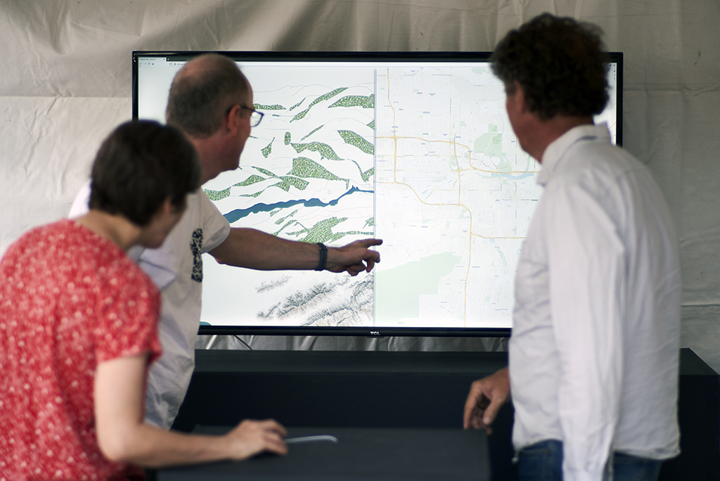
After many discussions with members of the archaeological community and local tribes, the concept of the A Deeper Map app was born: an educational app with a Google Maps-like interface. The contemporary map layer can be moved aside to reveal locations of the ancient, hand-dug canal paths below modern canals, roads, and buildings. Scottsdale Public Art was very excited about this idea as a way to bring a new understanding of the Valley’s story of water to the public. Scottsdale Public Art and Laugharn partnered to bring this project to life for Canal Convergence. Together we applied for the Arizona Community Foundation‘s Water Public Art Challenge grant, and we were one of five amazing public art projects to be awarded funds to make this project happen.
Over the next year, Laugharn and his team, with the support of Scottsdale Public Art and the Arizona Community Foundation, worked hard on multiple fronts to bring together all the pieces it takes to create an app of this scale. The first test was the creation of the website, which was presented to the public for testing and feedback at Canal Convergence 2019. Then, with all the content in place, this app, so long in the making, was finally completed and released to the public.

With A Deeper Map installed on your mobile device, you can geolocate your position and see exactly where you are relative to the ancient canal paths that made life and agriculture possible in the Lower Salt River Valley. You might find that where you work, live, or even take your dog for daily walks was once a water-bearing lifeline to ancient peoples.
In addition to being able to view your current location in both the modern and ancient maps, Laugharn has worked with Reuben Ringlero to create a series of informational videos that go into more depth about a certain location’s history. The video below is just one example of several you can view in the app.
Download the app for free on the Apple App Store or Google Play App Store. Just search for “A Deeper Map” and enjoy! Also, we would love to hear your thoughts and feedback, so send us your comments at [email protected].
Many people were involved in bringing this app to life. We would like to take this moment to offer our thanks to everyone who helped us get here. First and foremost, thank you to the Arizona Community Foundation for funding this project by selecting us for the Water Public Art Challenge grant. Next, we’d like to thank the Salt River Pima-Maricopa Indian Community Tribal Historic Preservation Office, the Gila River Indian Community Tribal Historic Preservation Office, and members of the archaeological community and other stakeholders who joined us in offering their thoughts about the app concept and content. Special thanks to Jerry Howard, Chris Caseldine, Reuben Ringlero, and Anthony Gray.

Back to Immerse home.
CONNECTIONS: Spark | Amplify | Inspire